
Cullman seawall repair & shoreline planning
Separate the city address from the county lake parcel. Cullman-area shoreline planning starts with the property record, Alabama Power approval and a workable route to the bank.
Describe your project on this page ↓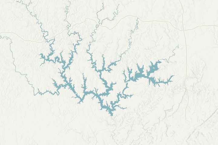
Map sources & limits
Lake shoreline and selected roads: U.S. Census Bureau, 2025 TIGER data. Terrain: USGS 3D Elevation Program. Community points: cited place records. Reviewed November 4, 2026. Simplified for orientation; not a property survey, current waterline or navigation chart.
Get to know your waterfront
Cullman is the county seat and an inland service center for many Smith Lake owners. The county’s Smith Lake Park carries a Cullman address at 403 County Road 386, but a mailing name alone does not establish city jurisdiction. Locate the actual parcel before asking an office to review a wall, driveway or drainage change.
Wikipedia · Cullman Map · Cullman County · Cullman Contacts · Cullman County · Cullman Road
Connect the parcel record to the road and shoreline plans
Start with Cullman County’s Revenue Commissioner at 256-775-4776 when identifying the tax parcel. Ask the Commission office at 256-775-4878 which local reviews apply to the site and work. A tax map helps find a record; it is not a boundary survey or a permit decision.
The county publishes a driveway pipe permit application. If heavy equipment needs a temporary entrance, a ditch crossing or a change at a county road, resolve that access before comparing wall prices. Ask who must approve the route and who repairs the entrance afterward.
Smith Lake Park is a useful orientation point and public recreation facility. Its boat launch is not automatically a loading area for a private construction project. A contractor proposing to use a park or public access should obtain the land manager’s permission rather than treating public entry as commercial authorization.
Local details that change the questions
- Cullman is an incorporated city as well as the county’s administrative center.
- Smith Lake Park is at 403 County Road 386 with a Cullman mailing address.
- The official tourism directory lists recreational boat access at the park.
- The county Revenue Commissioner provides the parcel-record starting point.
- County road resources include a driveway pipe permit application.
Related planning: Cullman County shoreline guide · riprap scope · condition assessment.
What could the work cost?
Separate equipment access and driveway restoration from the shoreline installation price. If the site needs a survey, drainage work or health review, leave those amounts visible until priced.
These are national price ranges from HomeGuide, not Smith Lake quotes. Wall height, access by land or water and the work included can change your total.
Compare quotes and plan a budget →Find the relevant permits and records
| Starting point | What to resolve | Prepare and look up |
|---|---|---|
Alabama Power · Smith Lake | Shoreline structure and bank work within project rights. | Permit tag, deed, parcel, existing and proposed sketch. Call 205-384-7385. |
Cullman County | Confirm parcel jurisdiction, road access and applicable local reviews. | Use the actual property address and parcel number; a mailing city is not a jurisdiction decision. |
ADEM / USACE when applicable | Construction stormwater and federal in-water or fill authorization. | Complete disturbance area, method, footprint and disposal plan. |
A property-to-shoreline records folder
Use this sequence to prepare the site-specific records and questions. It is a planning checklist, not an approval or a contractor availability claim.
Find the parcel
Match the deed, tax parcel and actual lake address.
Resolve local authority
Ask the county whether the property is inside a municipality and which reviews apply.
Check the approach
Document the driveway, ditch, utilities and proposed equipment route.
Prepare one complete sketch
Include shoreline work and related access disturbance in the information sent for review.
Tell us about your Cullman area shoreline
Use the lake-property location and describe the change you noticed. Add the existing tag or survey later if available.
Clear guidance for your lakefront project.
Cullman project questions
Can a contractor use Smith Lake Park to bring equipment to my lot?
Do not assume so. A public recreation launch is not automatic permission for commercial staging or construction access. Ask the park manager and contractor to confirm the proposed use in writing.
What should I send before an assessment?
Start with the actual lake location and safe, dated photos. Existing approval tags, surveys and repair records help the professional understand the scope. Use the assessment checklist to organize them.
Keep planning
Nearby waterfront guides
Show sourcesHide sources
- Wikipedia · Cullman MapSource reviewed 2026-11-04
- Cullman County · Cullman ContactsSource reviewed 2026-11-04
- Cullman County · Cullman RoadSource reviewed 2026-11-04
- Smith Lake residential shoreline guidelines · July 2025Source reviewed 2026-11-04
- ADEM · Adem StormwaterSource reviewed 2026-11-04
- USACE · Regulatory Request SystemSource reviewed 2026-11-04
- Cullman County Tourism Bureau · Cullman ParkSource reviewed 2026-11-04