
Crane Hill seawall repair & shoreline planning
Crane Hill shoreline projects need a clear plan for the slope, drainage and equipment route. Check the lot’s access and approval before selecting a wall or stone treatment.
Describe your project on this page ↓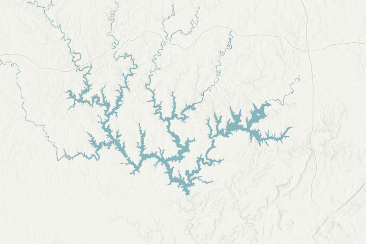
Map sources & limits
Lake shoreline and selected roads: U.S. Census Bureau, 2025 TIGER data. Terrain: USGS 3D Elevation Program. Community points: cited place records. Reviewed November 4, 2026. Simplified for orientation; not a property survey, current waterline or navigation chart.
Get to know your waterfront
Crane Hill is an unincorporated community in southwestern Cullman County. Smith Lake and freshwater streams wind through its surrounding hills. That geography makes the individual lot more useful than a broad community label: the driveway, bank, lake access and nearby structures determine how a contractor can reach and repair the shoreline.
Wikipedia · Crane Hill Place · Cullman County · Cullman Road · Cullman County · Cullman Contacts
Price the route down the lot as carefully as the shoreline
Walk the planned approach with the contractor before accepting an estimate. Identify turns, gates, trees, utilities and septic areas that need protection. If the route needs slope work, ask how temporary stability and runoff will be managed. A machine fitting through a gate does not prove the full route is suitable.
Confirm whether a county-road entrance or driveway pipe is affected. Cullman County publishes a driveway pipe permit application, and its offices can direct questions about the parcel. Show restoration limits in the estimate so damage to the approach is not left as an unpriced extra.
At the bank, compare riprap and natural stabilization with any proposed vertical wall. Alabama Power prefers those natural approaches and must approve backfill. The guideline contours should be located through the property records and survey, not guessed from a low-water photograph.
Local details that change the questions
- Crane Hill is unincorporated, not an incorporated city permit office.
- It is in southwestern Cullman County.
- The community reference describes Smith Lake and streams through hilly terrain.
- Cullman County provides driveway-pipe and road-access resources.
- County parcel and health contacts are separate from Alabama Power’s shoreline office.
Related planning: Cullman County shoreline guide · riprap scope · condition assessment.
What could the work cost?
Request a separate access and restoration allowance. For a rock project, keep the specified stone quantity, placement method, filter and vegetation distinct from delivery alone.
These are national price ranges from HomeGuide, not Smith Lake quotes. Wall height, access by land or water and the work included can change your total.
Compare quotes and plan a budget →Find the relevant permits and records
| Starting point | What to resolve | Prepare and look up |
|---|---|---|
Alabama Power · Smith Lake | Shoreline structure and bank work within project rights. | Permit tag, deed, parcel, existing and proposed sketch. Call 205-384-7385. |
Cullman County | Confirm parcel jurisdiction, road access and applicable local reviews. | Use the actual property address and parcel number; a mailing city is not a jurisdiction decision. |
ADEM / USACE when applicable | Construction stormwater and federal in-water or fill authorization. | Complete disturbance area, method, footprint and disposal plan. |
A steep-lot access briefing
Use this sequence to prepare the site-specific records and questions. It is a planning checklist, not an approval or a contractor availability claim.
Photograph the route
Record driveway width, turns and protected features from safe ground.
Mark boundaries and utilities
Give the contractor the available survey and known service locations.
Compare land and water access
Ask for a feasible route and the permissions it needs.
Price restoration
Specify drive, slope, lawn and planting repairs in the same written scope.
Tell us about your Crane Hill area shoreline
Use the lake-property location and describe the change you noticed. Add the existing tag or survey later if available.
Clear guidance for your lakefront project.
Crane Hill project questions
Can the contractor quote from lakefront photos alone?
Photos help start the conversation, but they do not establish access, buried services, slope stability or concealed wall condition. Ask for a site-specific assessment before treating a remote price as a complete scope.
What should I send before an assessment?
Start with the actual lake location and safe, dated photos. Existing approval tags, surveys and repair records help the professional understand the scope. Use the assessment checklist to organize them.
Keep planning
Nearby waterfront guides
Show sourcesHide sources
- Wikipedia · Crane Hill PlaceSource reviewed 2026-11-04
- Cullman County · Cullman RoadSource reviewed 2026-11-04
- Cullman County · Cullman ContactsSource reviewed 2026-11-04
- Smith Lake residential shoreline guidelines · July 2025Source reviewed 2026-11-04
- ADEM · Adem StormwaterSource reviewed 2026-11-04
- USACE · Regulatory Request SystemSource reviewed 2026-11-04